-
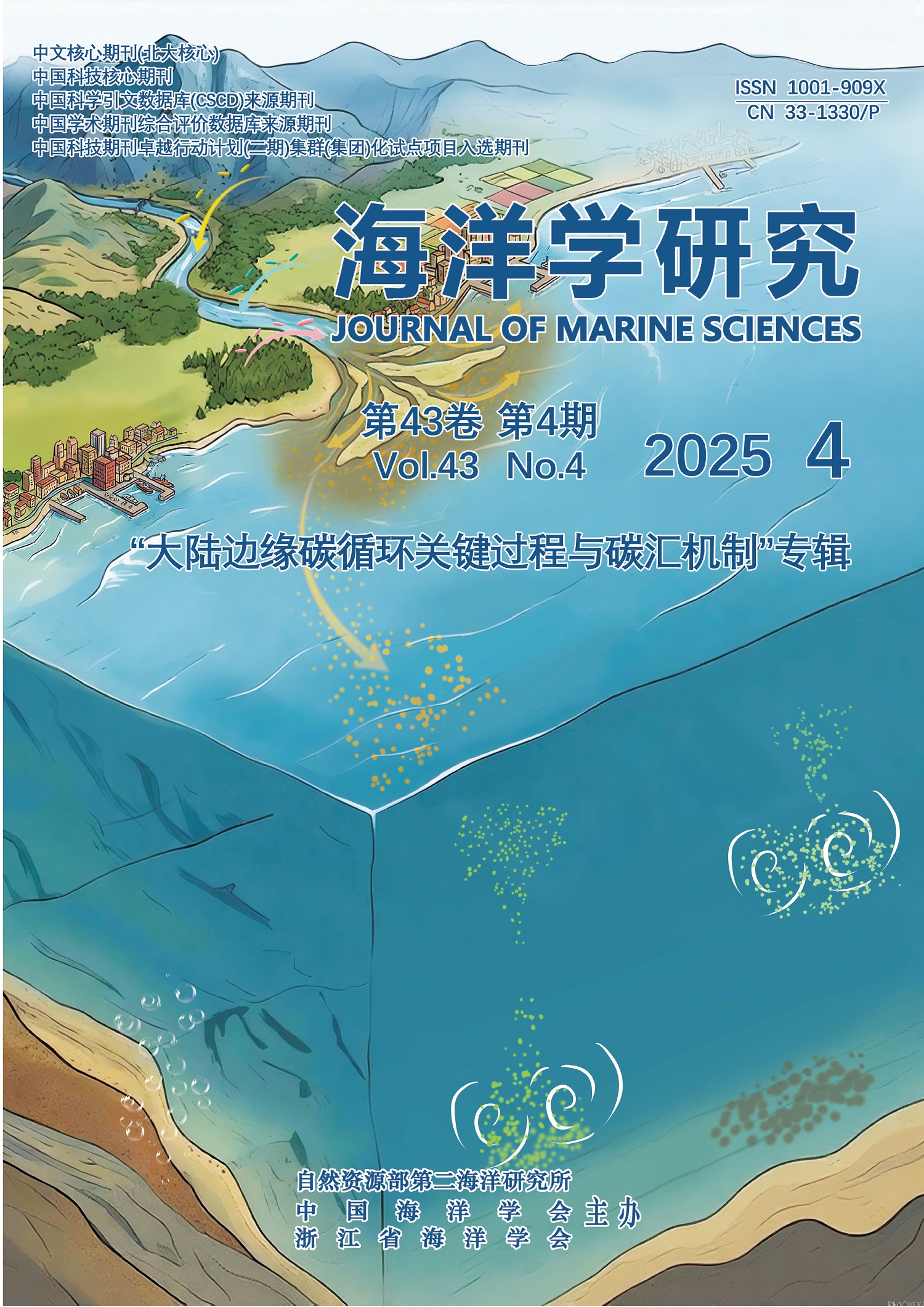
The sediment source-to-sink system serves as a critical link connecting active carbon pools (e.g., atmosphere, biosphere, hydrosphere) with the stable lithospheric carbon pool, playing a core buffering role in the global carbon cycle. As the core area of marine sedimentary carbon sinks, delta-shelf regions account for over 80% of the global marine sedimentary organic carbon flux while occupying less than 8% of the global ocean area. The processes and mechanisms of carbon burial in these regions are crucial for global carbon balance. This paper systematically reviews the source composition and sedimentary flux characteristics of terrestrial organic carbon in delta-shelf sedimentary systems, focuses on elaborating organic carbon source-to-sink tracing technologies, remineralization processes and their dominant mechanisms, analyzes the impacts of human activities on sedimentary carbon sinks, and discusses marine negative emission and carbon sequestration enhancement schemes based on sediment management. Studies show that the heterogeneity of terrestrial organic carbon, physicochemical conditions of the sedimentary environment, and human disturbance collectively regulate the migration, transformation, and burial efficiency of organic carbon. Currently, the potential of sedimentary carbon sinks has not been fully exploited; thus, it is urgent to promote the integration of sedimentary carbon sinks into the global climate governance system through methodological innovation, mechanism deepening, and technological development, so as to provide scientific support and feasible paths for achieving the temperature control goals of the Paris Agreement.
-
Deep-water sedimentary processes are key drivers that shape seafloor topography and actively participate in marine material cycles, thereby playing a crucial role in the formation of depositional systems and material cycling along continental margins and within deep-sea basins. The transport and transformation of carbon elements and carbon-containing substances are essential for sustaining organic life and maintaining climate stability. As an important end-member reservoir in this cycle, deep-sea sediments act as efficient sinks for atmospheric greenhouse gases, exerting significant regulatory effects on climate evolution over geological timescales. This study aims to elucidate the coupling mechanisms between distinctive deep-water sedimentary processes and organic carbon burial, providing a theoretical basis for establishing the “Shelf edge-slope-deep sea basin organic matter continuous transport system” and the “Deep-water organic carbon burial pyramid model”. By comprehensively analyzing representative deep-water organic carbon burial systems in global ocean basins, this research demonstrates that turbidity currents and bottom currents are the main dynamic mechanisms enabling the continuous transport of deep-water organic matter. The (micro)biological carbon pump, turbidity current carbon pump, bottom current carbon pump, and deep stratigraphic carbon pump together form the core framework for deep-water sedimentary carbon burial. Furthermore, the factors influencing deep-water organic carbon burial outcomes exhibit hierarchical characteristics. However, current research on deep-water organic carbon burial is still in its early stages, with limited case studies and mechanistic understanding, underscoring the urgent need to strengthen research on carbon burial processes in deep-water environments.
-
Black carbon (BC), a refractory organic carbon, is produced during the incomplete combustion of biomass and fossil fuels. Globally, an estimated 3%-10% of the annual BC production ultimately buried in marine sediments. As a critical component of the inert carbon pool, its spatiotemporal distribution and source-to-sink processes are essential for understanding global carbon cycling and climate evolution. Based on published BC data from nearly 1 000 marine sediment samples worldwide, this study reveals that BC contents vary widely, from 0.02 to 9.72 mg/g, with averaging 1.06 mg/g and accounting for an average of 15.1% of total sedimentary organic carbon. Spatial patterns are controlled by sediment grain size, organic carbon content, and depositional environments while temporal variations reflect the combined influence of climate change and human activities. Current knowledge of marine sedimentary BC sources predominantly assumes terrestrial dominance, with riverine transport, atmospheric deposition, and coastal erosion as primary input pathways. However, emerging evidence indicates that BC sinking fluxes in mid- to deep-ocean layers substantially exceed known terrestrial supply. This raises the possibility of potential unidentified sources. In addition, BC degradation and recycling processes within the marine systems remain poorly understood. Future research must prioritize source-to-sink dynamics in key areas (e.g., deep-sea environment) by integrating geochemical and organic molecular isotopic techniques to resolve BC cycling mechanisms and address current budget imbalances.
-
Research progress on the mechanism of sedimentary carbon sink in delta-shelf systemsFAN Daidu, ZHANG Qiaowen, WU Yijing, SU Jianfeng, WEI Bingbing, NI Sha2025, 43(4):3-20. DOI:10.3969/j.issn.1001-909X.2025.04.001
-
Deep-water sedimentary processes and organic carbon burial effectsSU Ming, MA Wenbin, LUO Kunwen, GAO Ya, OU Hejie2025, 43(4):21-40. DOI:10.3969/j.issn.1001-909X.2025.04.002
-
Distribution, sources and burial flux of black carbon in marine sedimentsWANG Jialun, YU Zenghui, HU Limin, BAI Yazhi, YU Wenxiu, CHONG Weini, ZHOU Jiawen, RAN Xue, BAI Jinming2025, 43(4):41-58. DOI:10.3969/j.issn.1001-909X.2025.04.003
-
Research progress on the carbon cycle process of seagrass-mangrove continuumGU Xiaoxuan, MENG Yue, CHEN Luzhen2025, 43(4):59-70. DOI:10.3969/j.issn.1001-909X.2025.04.004
-
Distribution, source and degradation characteristics of surface soil organic carbon in typical habitats of the Yellow River Estuary wetlandNI Xin, ZHAO Guangming, ZHANG Yao, WANG Weihua, SU Dapeng, LU Feng, KANG Zhiqiang, KANG Fei2025, 43(4):71-78. DOI:10.3969/j.issn.1001-909X.2025.04.005
-
Quantification and source analysis of inorganic carbon pools in seagrass meadows in Li’an Lagoon, HainanQIAN Yuchen, GU Ruiting, SHEN Wei, LIU Youcai, ZHAO Ning2025, 43(4):79-88. DOI:10.3969/j.issn.1001-909X.2025.04.006
-
Composition of dissolved metabolites in the Changjiang River Estuary front under tidal influenceCHEN Xiaofen, XU Ke, WANG Ruyu, CHEN Huangxin, WANG Yasong, FENG Zhixuan, ZHAO Xueqin, WU Weichao2025, 43(4):89-102. DOI:10.3969/j.issn.1001-909X.2025.04.007
-
Provenance and transport patterns of particulate organic carbon in the estuarine turbidity maximum zone of the Jiulong River Estuary, southern ChinaYU Fengling, ZHOU Yanren, LIU Yuze, LI Jiaying, GAO Ruixi, HOU Yishu, ZHANG Muyi, YU Dan, YU Zhihao, HOU Yanni, LIU Wenhui, LING Haiyi, CHEN Nengwang2025, 43(4):103-114. DOI:10.3969/j.issn.1001-909X.2025.04.008
-
Net sedimentary and carbon burial effects of Typhoon Chanthu: A quantitative study based on repetitive coring and radionuclides tracing in the Hangzhou BayWU Yijing, FANG Lin, SU Jianfeng, FAN Daidu2025, 43(4):115-127. DOI:10.3969/j.issn.1001-909X.2025.04.009
-
Evolution of organic carbon burial in the Changjiang Delta during the mid-to-late HoloceneSU Jianfeng, WU Yijing, FAN Daidu2025, 43(4):128-140. DOI:10.3969/j.issn.1001-909X.2025.04.010
-
Labile characteristics of shallow sedimentary organic carbon in the East China Sea and its influencing factorsWANG Jian, SUN Xueshi, CHENG Peng, ZHANG Xin, REN Xiaolin, FAN Dejiang2025, 43(4):141-150. DOI:10.3969/j.issn.1001-909X.2025.04.011
-
The role of reactive iron in the preservation of sedimentary organic carbon in the Pearl River Estuary-northern South China SeaZHANG Zhuoyue, ZHANG Chuchu, QIU Yifei, WANG Chenglong, ZOU Xinqing2025, 43(4):151-161. DOI:10.3969/j.issn.1001-909X.2025.04.012
| 2025,Vol.43 | No.3 | No.2 | No.1 | |
| 2024,Vol.42 | No.4 | No.3 | No.2 | No.1 |
| 2023,Vol.41 | No.4 | No.3 | No.2 | No.1 |
| 2022,Vol.40 | No.4 | No.3 | No.2 | No.1 |
| 2021,Vol.39 | No.4 | No.3 | No.2 | No.1 |
| 2020,Vol.38 | No.4 | No.3 | No.2 | No.1 |
| 2019,Vol.37 | No.4 | No.3 | No.2 | No.1 |
| 2018,Vol.36 | No.4 | No.3 | No.2 | No.1 |
| 2017,Vol.35 | No.4 | No.3 | No.2 | No.1 |
| 2016,Vol.34 | No.4 | No.3 | No.2 | No.1 |
| 2015,Vol.33 | No.4 | No.3 | No.2 | No.1 |
| 2014,Vol.32 | No.4 | No.3 | No.2 | No.1 |
| 2013,Vol.31 | No.4 | No.3 | No.2 | No.1 |
| 2012,Vol.30 | No.4 | No.3 | No.2 |
-
HE Maoyu, WANG Jing, LI Sihan, LIANG LewenJournal of Marine Sciences. 2025 Vol. 43 (1): 22-33 DOI: 10.3969/j.issn.1001-909X.2025.01.003
-
HE Xinyi, LIU Qian, LI Xiaohu, LI Zhenggang, WANG Hao, ZHU Zhimin, LI HuaimingJournal of Marine Sciences. 2025 Vol. 43 (1): 34-46 DOI: 10.3969/j.issn.1001-909X.2025.01.004
-
YANG Bo, ZHANG Zhuo, ZHOU Jin, LIN Ziyi, XIE Ziqiang, ZHENG Huina, LIAO Baolin, XIAO BaohuaJournal of Marine Sciences. 2025 Vol. 43 (1): 90-106 DOI: 10.3969/j.issn.1001-909X.2025.01.009
-
HUANG Shuyi, XIE Xiaohui, LI ShaofengJournal of Marine Sciences. 2025 Vol. 43 (1): 1-13 DOI: 10.3969/j.issn.1001-909X.2025.01.001
-
ZHANG Xuan, LIU Zenghong, CHEN Zhaohui, REN Chong, XIONG Haixia, GAO Zhiyuan, YAN Xiaoluan, ZHANG LinlinJournal of Marine Sciences. 2025 Vol. 43 (1): 14-21 DOI: 10.3969/j.issn.1001-909X.2025.01.002
-
JIN Jie, CHEN Yujie, YAO Yongheng, ZHANG Siyuan, HU Zhentao, DING Mengrong, JIA BinJournal of Marine Sciences. 2025 Vol. 43 (1): 69-78 DOI: 10.3969/j.issn.1001-909X.2025.01.007
-
WANG Yang, QUAN Xin, ZHUANG Ya, ZHAO Huade, SU JianzhongJournal of Marine Sciences. 2025 Vol. 43 (1): 79-89 DOI: 10.3969/j.issn.1001-909X.2025.01.008
-
HAN Yajing, ZHENG Liwen, LI Chenglong, ZHANG Yong, ZHAI WeidongJournal of Marine Sciences. 2025 Vol. 43 (2): 1-10 DOI: 10.3969/j.issn.1001-909X.2025.02.001
-
HOU Zonghao, ZHANG Yifei, FANG Xin, DUAN YixinJournal of Marine Sciences. 2025 Vol. 43 (1): 57-68 DOI: 10.3969/j.issn.1001-909X.2025.01.006
-
WANG Xiuping, YANG Pengcheng, LIU FangyuanJournal of Marine Sciences. 2025 Vol. 43 (1): 47-56 DOI: 10.3969/j.issn.1001-909X.2025.01.005
-
CHANG Lexin, ZHU Bozhong, GUO Mao, LI Teng, GONG Fang, ZHU Qiankun, BAI YanJournal of Marine Sciences. 2025 Vol. 43 (2): 47-57 DOI: 10.3969/j.issn.1001-909X.2025.02.006
-
WANG Dazhi, LIAN TaoJournal of Marine Sciences. 2025 Vol. 43 (3): 1-10 DOI: 10.3969/j.issn.1001-909X.2025.03.001
-
LÜ Congcong, YU Yang, LI Bin, SHUI Bonian, HU ChengyeJournal of Marine Sciences. 2025 Vol. 43 (2): 88-96 DOI: 10.3969/j.issn.1001-909X.2025.02.010
-
HUAN Caiyun, JIANG Zhenqiang, XU Kundi, WANG JiaxinJournal of Marine Sciences. 2025 Vol. 43 (2): 19-29 DOI: 10.3969/j.issn.1001-909X.2025.02.003
-
DING Hao, ZHANG Penghui, CHEN ChaoJournal of Marine Sciences. 2025 Vol. 43 (3): 60-72 DOI: 10.3969/j.issn.1001-909X.2025.03.007
-
LI Guoxiang, LUO Xiaowen, WAN Hongyang, CUI Jiaxin, WEI WeiJournal of Marine Sciences. 2025 Vol. 43 (2): 58-66 DOI: 10.3969/j.issn.1001-909X.2025.02.007
-
FEI Yichu, YANG Zhi, ZHOU Yadong, ZHANG DongshengJournal of Marine Sciences. 2025 Vol. 43 (3): 81-91 DOI: 10.3969/j.issn.1001-909X.2025.03.009
-
WENG Zebang, LI Xiaohu, LI Jie, LI Zhenggang, WANG Hao, ZHU Zhimin, MENG Xingwei, LI HuaimingJournal of Marine Sciences. 2025 Vol. 43 (3): 32-39 DOI: 10.3969/j.issn.1001-909X.2025.03.004
-
ZHU Lunjia, QU Ke, WANG Xu, WANG Chao, LI TiankuoJournal of Marine Sciences. 2025 Vol. 43 (1): 107-121 DOI: 10.3969/j.issn.1001-909X.2025.01.010
-
LIU Liping, CHU Fengyou, GUO Lei, LI XiaohuJournal of Marine Sciences. 2023 Vol. 41 (1): 26-44 DOI: 10.3969-j.issn.1001-909X.2023.01.003
-
CAO Wenting, ZHANG Huaguo, LI RuiJournal of Marine Sciences. 2021 Vol. 39 (4): 123-131 DOI: 10.3969/j.issn.1001-909X.2021.04.012
-
Assessment of carbon sink potential and driving factors of island forests on national nature reserveWU Liangxu, ZOU Huimin, CHEN Wei, XU Minghai, CAI Houcai, CHEN Shuyi, LI XianglanJournal of Marine Sciences. 2023 Vol. 41 (1): 96-109 DOI: 10.3969-j.issn.1001-909X.2023.01.008
-
SONG Wanjiao, ZHANG Peng, SUN Ling, TANG Shihao, ZHOU Fangcheng,Journal of Marine Sciences. 2022 Vol. 40 (2): 10-18 DOI: 10.3969-j.issn.1001-909X.2022.02.002
-
DONG Changming, WANG Ziyun, XIE Huarong, XU Guangjun, HAN Guoqing, ZHOU Shuyi, XIE Wenhong, SHEN Xiangyu, HAN LeiJournal of Marine Sciences. 2024 Vol. 42 (3): 2-27 DOI: 10.3969/j.issn.1001-909X.2024.03.001
-
LI YanJournal of Marine Sciences. 2022 Vol. 40 (3): 9-16 DOI: 10.3969-j.issn.1001-909X.2022.03.002
-
CUI Minghui, TU Junbiao, MENG Lingpeng, GUO Xingjie, SU Ni, FAN DaiduJournal of Marine Sciences. 2023 Vol. 41 (2): 28-44 DOI: 10.3969/j.issn.1001-909X.2023.02.003
-
LIN Junchuan, KONG Deming, CHEN Fajin, HUANG Chao,Journal of Marine Sciences. 2022 Vol. 40 (3): 49-61 DOI: 10.3969-j.issn.1001-909X.2022.03.005
-
GE Yuyu, LIAO GuanghongJournal of Marine Sciences. 2023 Vol. 41 (2): 45-60 DOI: 10.3969/j.issn.1001-909X.2023.02.004
-
ZENG Dingyong, XUAN Jiliang, HUANG Daji, et alJournal of Marine Sciences. 2022 Vol. 40 (1): 12-20 DOI: 10.3969/j.issn.1001-909X.2022.01.002
-
CHEN Yining, CHEN LuzhenJournal of Marine Sciences. 2023 Vol. 41 (1): 3-13 DOI: 10.3969-j.issn.1001-909X.2023.01.001
-
Journal of Marine Sciences. 2022 Vol. 40 (3): 99-108 DOI: 10.3969-j.issn.1001-909X.2022.03.009
-
Journal of Marine Sciences. 2022 Vol. 40 (3): 17-32 DOI: 10.3969-j.issn.1001-909X.2022.03.003
-
XU Xucheng, YU Xing, HU Hang, HE Hu, YU Ya’naJournal of Marine Sciences. 2024 Vol. 42 (2): 104-112 DOI: 10.3969/j.issn.1001-909X.2024.02.010
-
CHEN Jianfang, ZHAI Weidong, WANG Bin, LI Dewang, XIONG Tianqi, JIN Haiyan, LI Hongliang, LIU Qinyu, MIAO Yanyi,Journal of Marine Sciences. 2021 Vol. 39 (4): 11-21 DOI: 10.3969/j.issn.1001-909X.2021.04.002
-
ZHENG Mengke, FANG Wei, ZHANG XiaozhiJournal of Marine Sciences. 2024 Vol. 42 (3): 51-63 DOI: 10.3969/j.issn.1001-909X.2024.03.004
-
JIN Quan, ZHANG Chuqing, WU Jianbo, ZHANG Xiao, YE Ying, HUANG Yuanfeng, TAO ChunhuiJournal of Marine Sciences. 2021 Vol. 39 (2): 52-59 DOI: 10.3969/j.issn.1001-909X.2021.02.006
-
MA Haibo, LAI Xianghua, HU Taojun, FU XiaomingJournal of Marine Sciences. 2024 Vol. 42 (1): 83-90 DOI: 10.3969/j.issn.1001-909X.2024.01.008
-
MENG Yu, CHEN ShuanglingJournal of Marine Sciences. 2023 Vol. 41 (3): 1-13 DOI: 10.3969/j.issn.1001-909X.2023.03.001
-
LI Zhichao, GUO Junru, SONG Jun, BAI Zhipeng, FU Yanzhao, CAI Yu, WANG XifengJournal of Marine Sciences. 2022 Vol. 40 (4): 1-10 DOI: 10.3969j.issn.1001-909X.2022.04.001


